ACTIVITY KENTING〔LIST〕
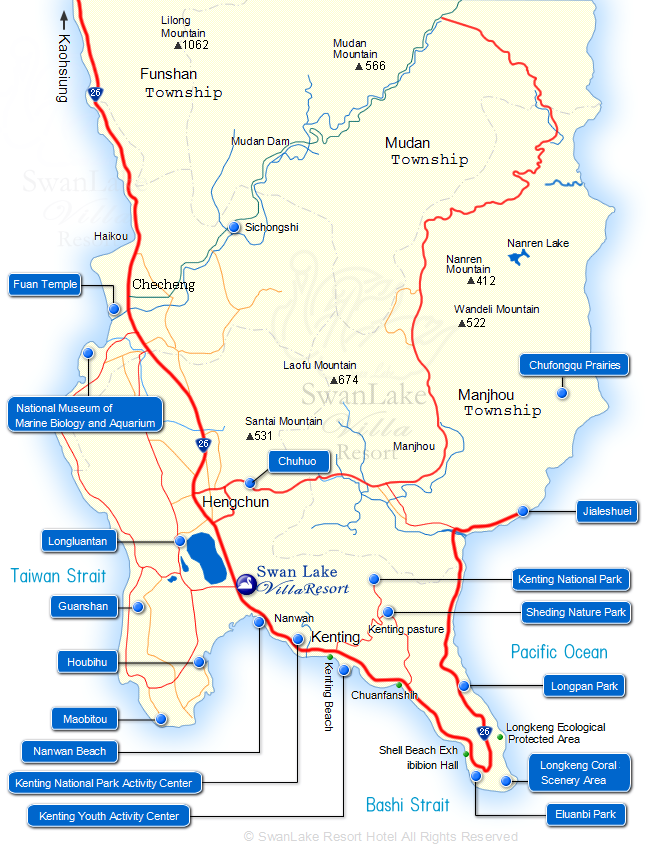
Kenting Tourist Map
Kenting Tourist Map - Swan lake Villa Resort
Nanwan Beach
Sisal Industry History Exhibition
Longluantan
Guanshan
Houbihu
Maobitou
Kenting National Park Headquarters
Chuanfanshih
Shadao
Eluanbi Park
Kenting National Park
Sheding Nature Park
Longpan Park
Jialeshuei
Longkeng Ecological Protection Area
Fuan Temple
National Museum of Marine Biology and Aquarium
Chuhuo